Equipment & Software for Geophysical Surveys: Design, Manufacture, Support, Supply
Terrain-following system – True Terrain Following
Automatic True Terrain Following (ATTF) is an advanced autopilot technology that allows an unmanned aerial vehicle (UAV) to automatically and accurately follow the contours of the terrain while maintaining a constant preset height above the ground.
Unlike maintaining a fixed altitude above mean sea level (AMSL), ATTF ensures flight at a constant height relative to the ground itself (AGL), which is critically important for missions in areas with variable terrain. Two altimeter versions are available: laser and radar.
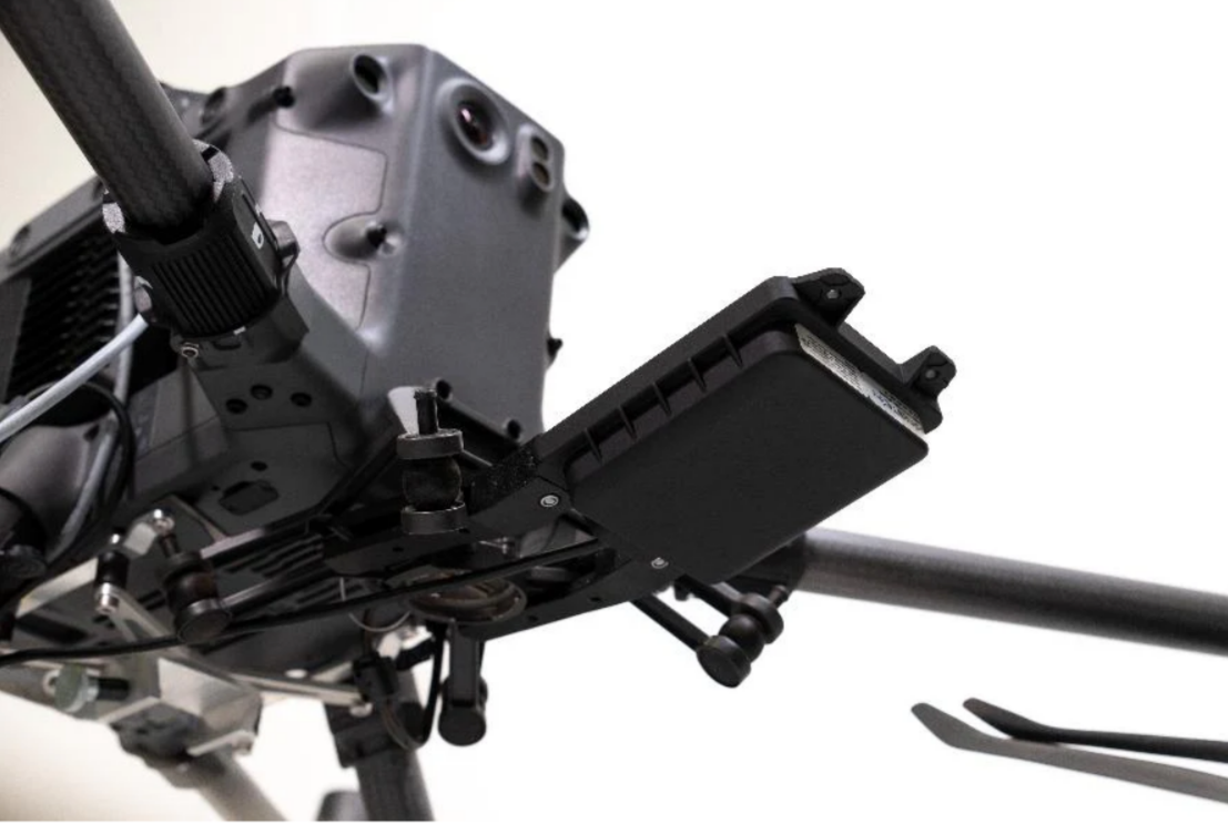
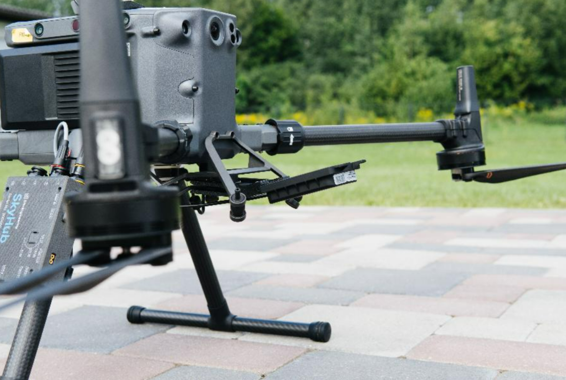
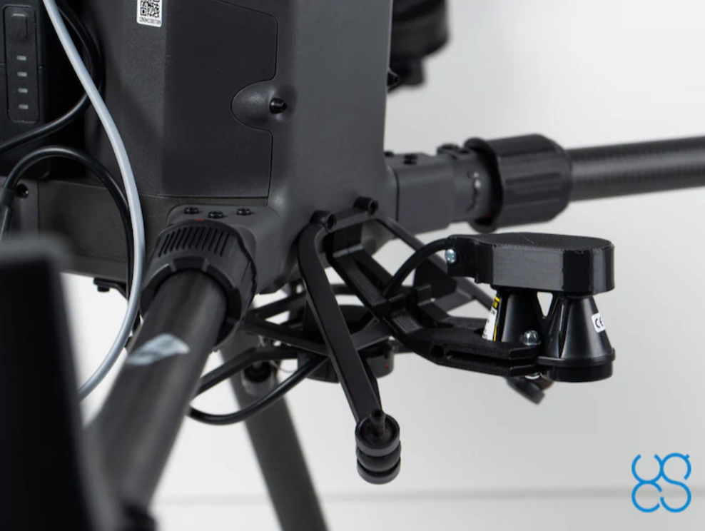
1. Laser Altimeter: A compact and lightweight altimeter designed for accurate measurement of a drone’s height above the ground or water surface. It ensures safe and stable low-altitude flights, maintaining a constant distance from the terrain even under challenging conditions.
2. Radar Altimeter: A 24 GHz altimeter used in conjunction with the SkyHub onboard computer for the True Terrain Following function. It measures the UAV’s actual height above the surface and transmits the data to SkyHub, enabling flight at a constant preset altitude even over complex terrain or water surfaces.
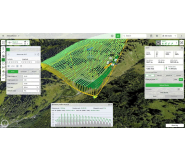
Applications:- Aerial photography and mapping
- Hydrography and marine research
- Operations in areas with complex terrain
- Surveying hard-to-reach locations
- Low-altitude UAV flights
- Infrastructure inspection and monitoring
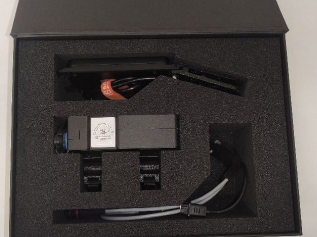
Laser altimeter:
- Laser altimeter
- Data cable
- Connector for SkyHub
- Software driver for SkyHub
- Plastic mounts for DJI M350/M300 RTK drones (mounts for other drones available upon request)
- 24 GHz radar altimeter
- Data cable
- Connector for SkyHub
- Software driver for SkyHub
- Plastic mounts for DJI M350/M300 RTK drones (mounts for other drones available upon request)
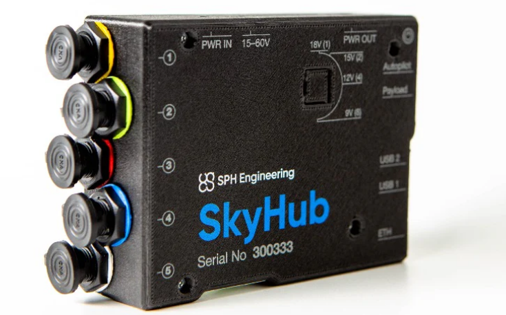
The SkyHub onboard computer is required to use the True Terrain Following system.
SkyHub is an industrial-grade onboard computer designed to expand the capabilities of commercial drones. It enables integration with a wide range of external sensors—including ground-penetrating radar (GPR), altimeter, magnetometer, echo sounder, and methane detector—and supports the recording of geotagged data directly on board. The device allows local processing and storage, ensuring data security without transmitting it to the cloud. As a third-generation platform, SkyHub offers enhanced switching capabilities, highly reliable interfaces, and support for industrial use cases.
Main features:- Supports various sensors (LiDARs, laser altimeters, gas analyzers, magnetometers, ground-penetrating radars)
- Compatibility with autopilots (DJI A3, Pixhawk, Cube, APM, etc.)
- Automatic terrain-following flight (TTF)
- Compatibility with DJI M300/M350 RTK and other drones
- Integration with UgCS and GeoTagger software
- Geodesy and archaeology
- Hydrography and water research
- Environmental monitoring
- Infrastructure inspection and mapping
- Scientific and industrial research
- SkyHub onboard computer
- Power cable
- Interface cables
- Mounts (adapted for various drone models, such as DJI M300 RTK and M350 RTK)
|
Parameter |
Value |
|
Compatible drones |
DJI M350 RTK (CPM 4.0.x); DJI M300 RTK (CPM 3.19.x); DJI M210 / M210 V2; DJI M600 / M600 Pro; Custom drones based on DJI; A3 and Pixhawk platforms with ArduCopter / PX4 |
|
Operating temperature |
−25 °C … +50 °C |
|
Output voltage |
9 / 12 / 15 / 18 V, up to 5 А |
|
Processing core |
Raspberry Pi Compute Module 4 |
|
Processor |
Cortex-A72 (ARM v8), 64-bit, up to 1.5 GHz |
|
Random Access Memory |
8 GB RAM |
|
Internal storage |
32 GB eMMC |
|
Operating System |
Ubuntu Server 21.04 |
|
Interfaces |
UART – up to 4; RS-232 – up to 2; GPIO – up to 4; USB – up to 2; Ethernet 10/100 Mbit; Wi-Fi 802.11 b/g/n/ac (dual-band); Bluetooth 5.0 (with BLE support) |
|
Weight |
195 g (without mounts) 215 g (with mounts for DJI M300) 220 g (with mounts for DJI M600) |