

Equipment & Software for Geophysical Surveys: Design, Manufacture, Support, Supply
Overhauser walking magnetometer-gradiometer MaxiMag

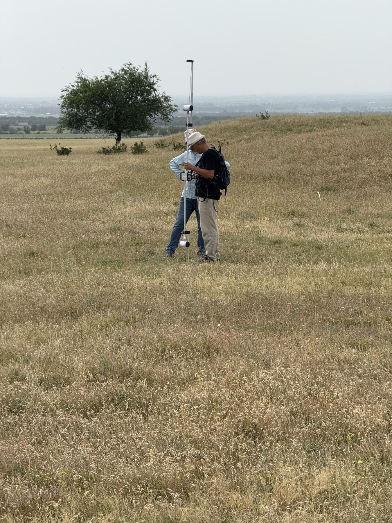
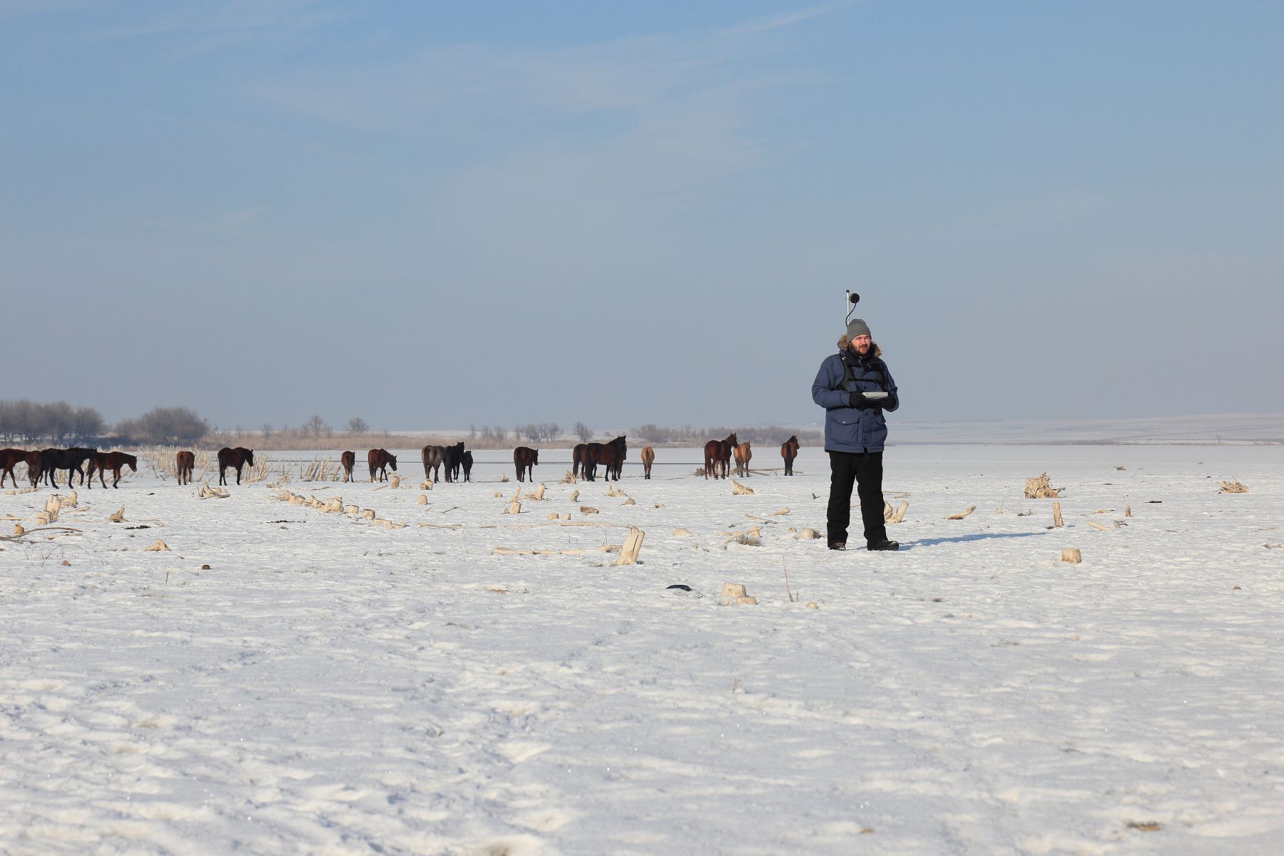
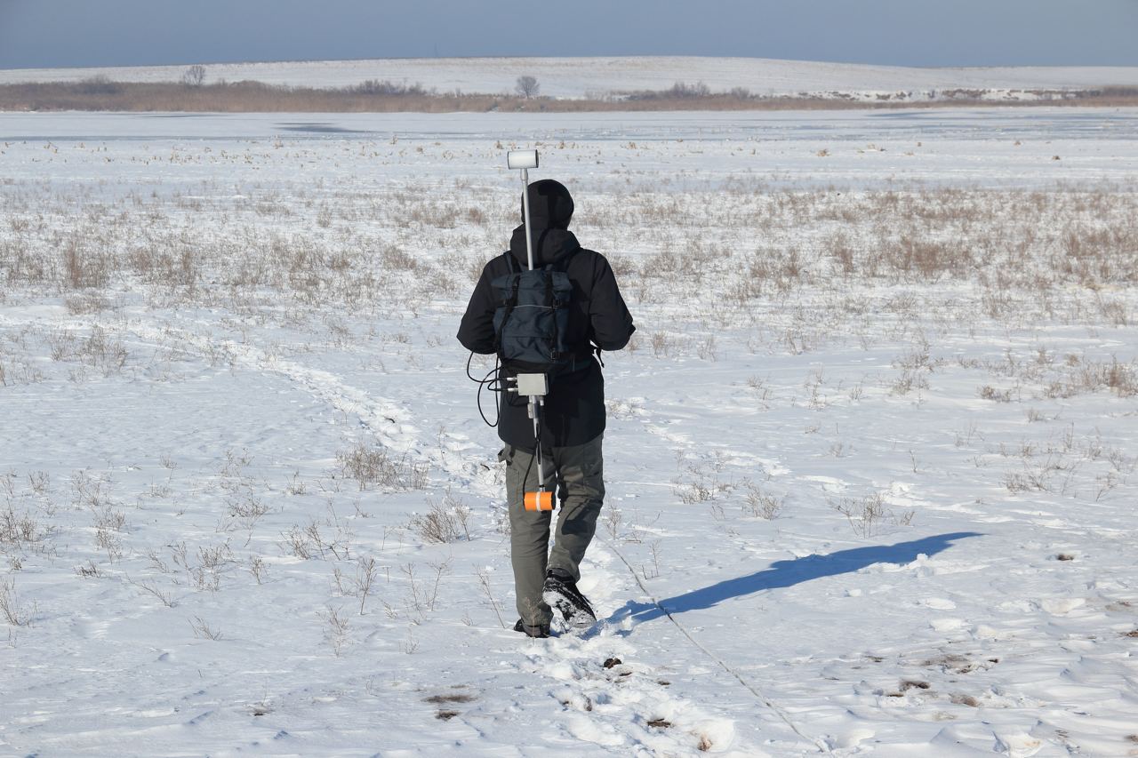

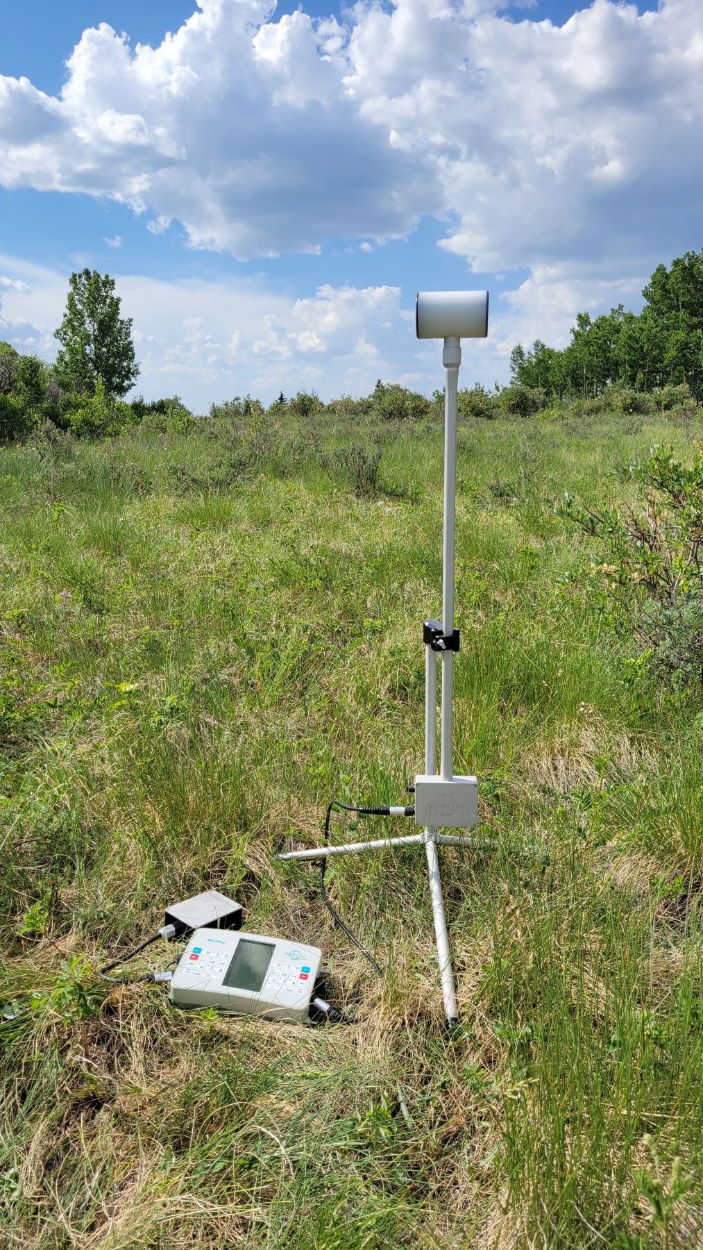
MaxiMag – the World's most advanced and portable walking Overhauser magnetometer. The instrument is designed to measure magnetic field with high sensitivity and absolute accuracy.
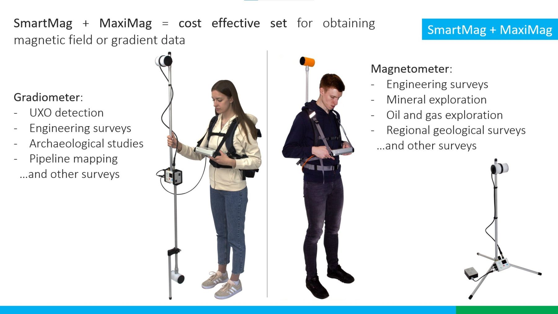
MaxiMag can be used as a walking magnetometer, two- or multi-sensor gradiometer, base station, observatory magnetometer, or even as a GNSS base and rover with centimeter accuracy in PPK mode. Console can be connected to a SmartMag magnetometers and recognizes them as a compatible sensors, so together they can be used as a walking magnetometer and a base station or as a gradiometer.
Perfect mobile magnetometer or gradiometer for any task
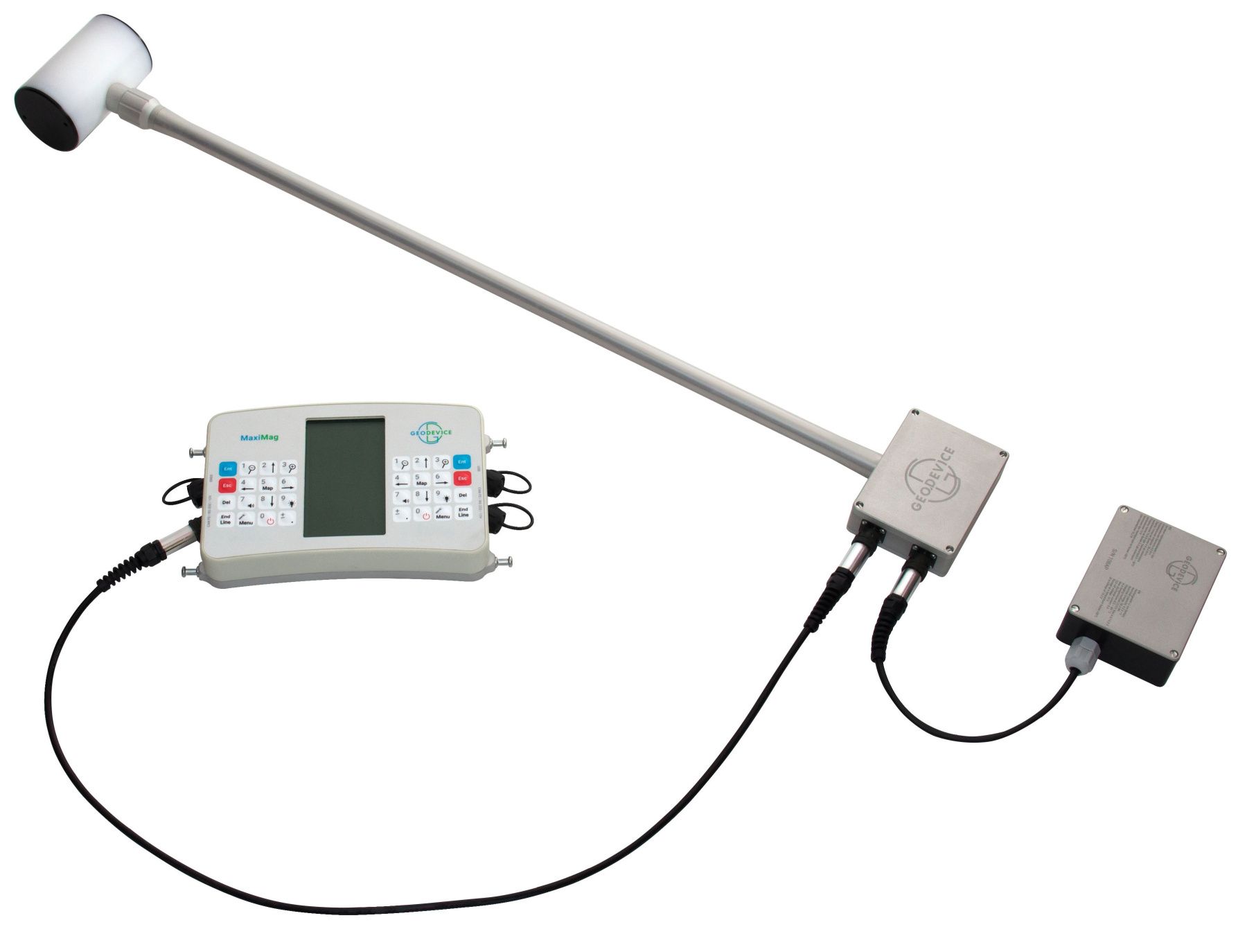
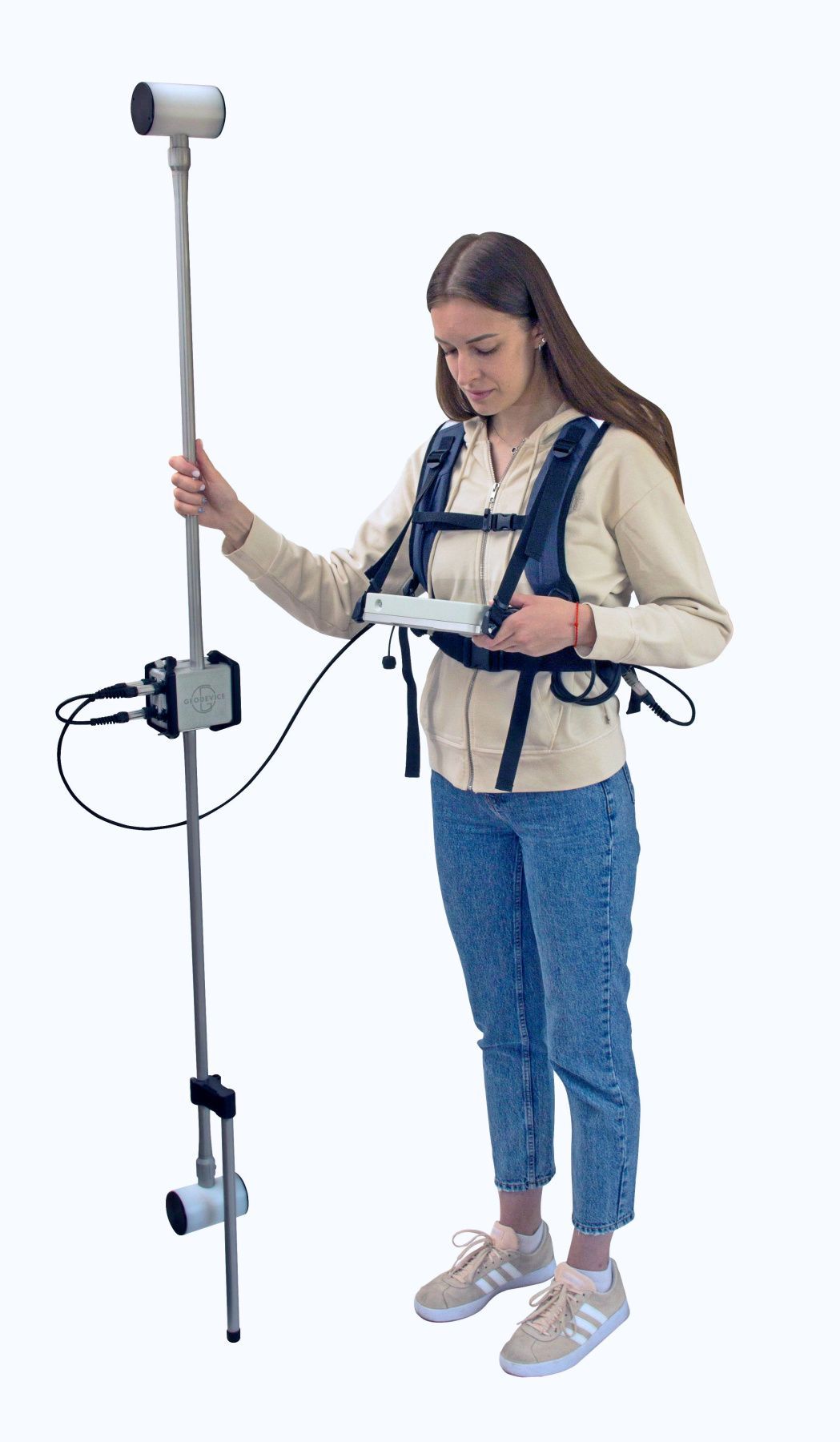
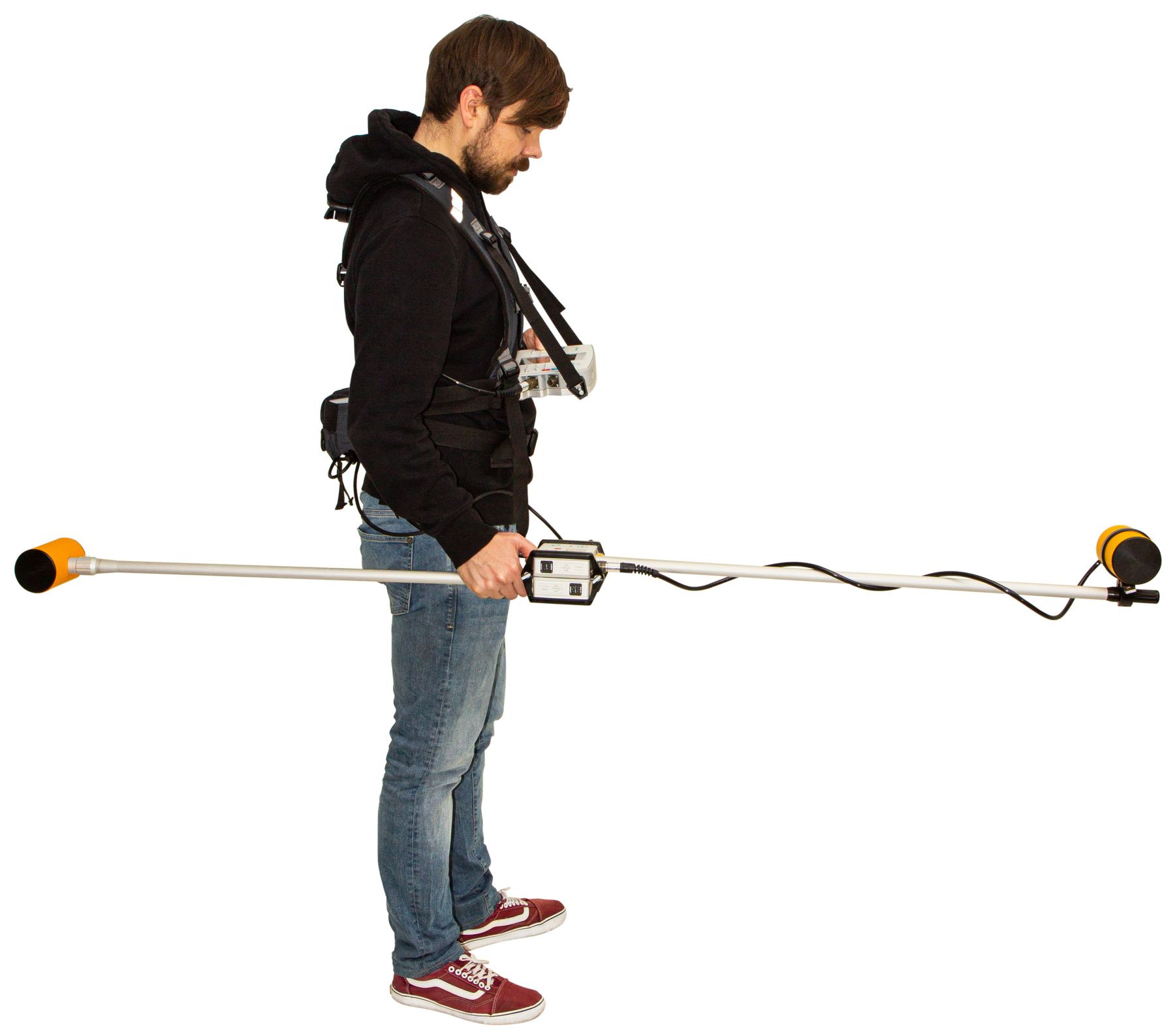
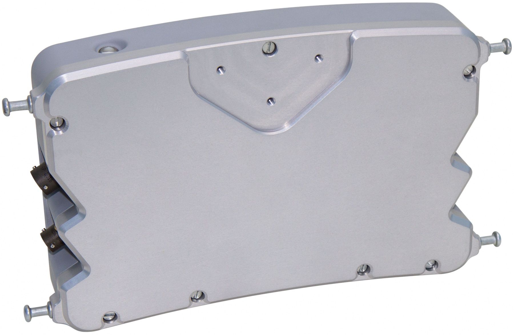
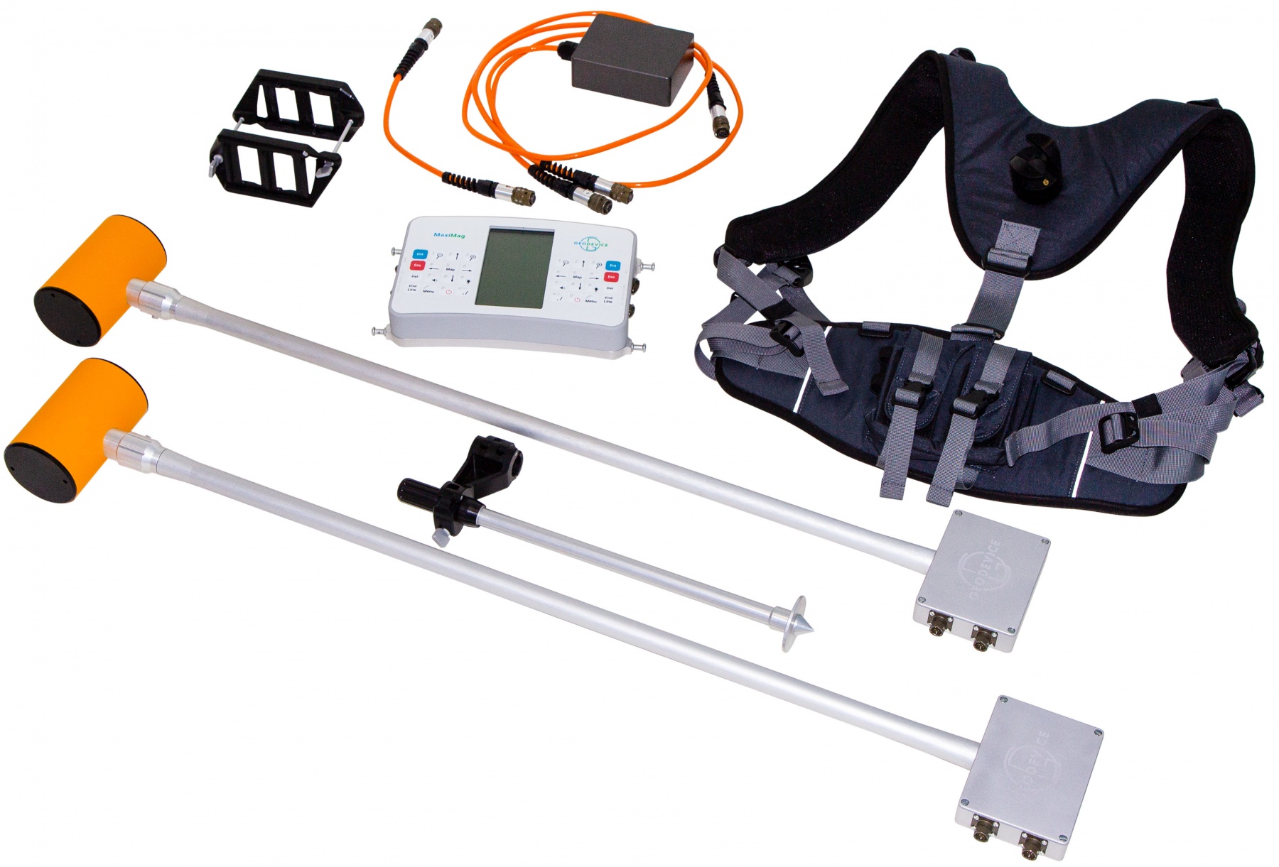
MaxiMag console permits connecting up to 30 digital Overhauser sensors or SmartMag magnetometers via a wired CAN interface. This unique feature enables building two- or multi-sensor gradiometers with the required measurement base and using any console-to-sensor distance.
Optional brackets and frames for any scenarios:
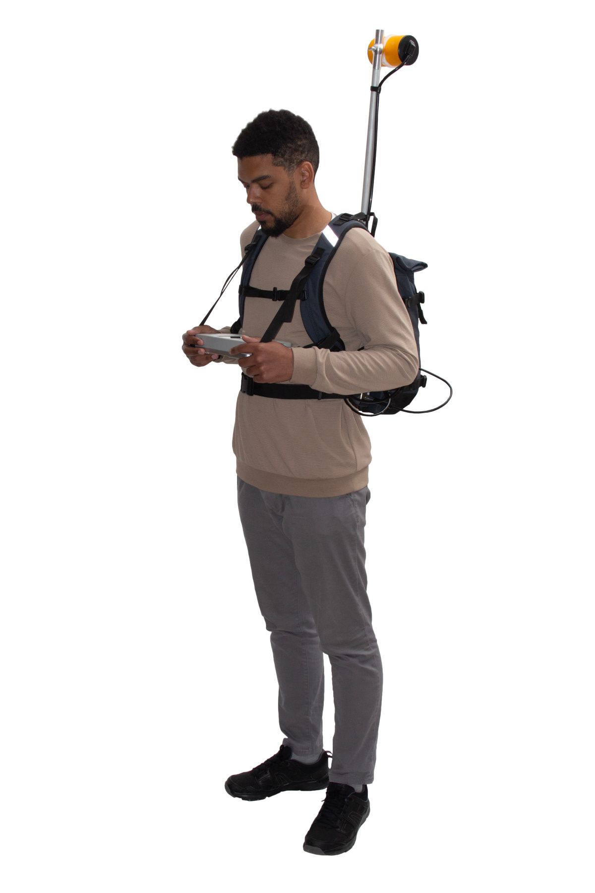
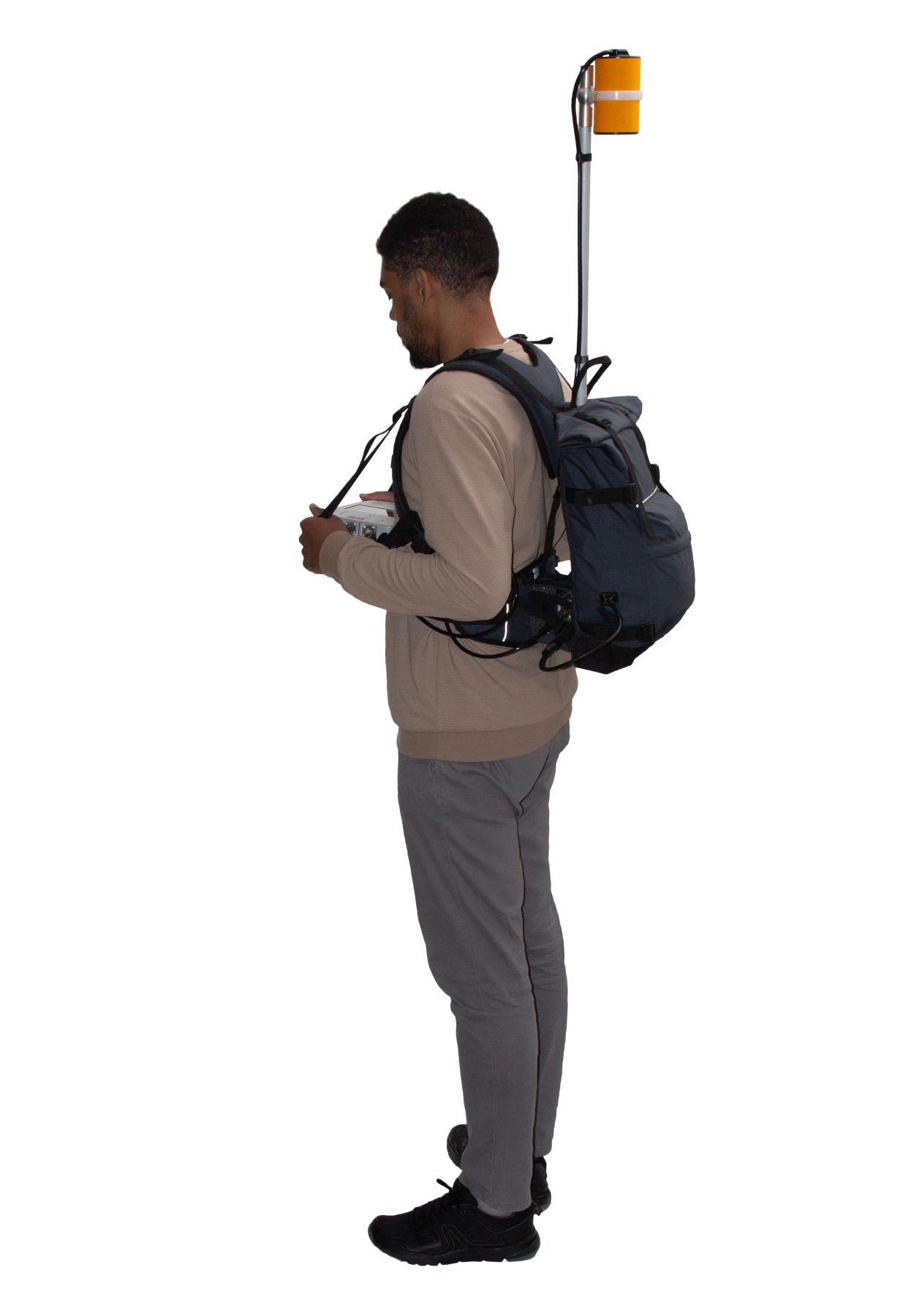
- Brackets for carrying two sensors in hand or in a backpack harness
- Versatile multi-sensor frame for cross-country and shallow water archaeological surveys
- Cart for multi-sensor gradiometer
- Sled for magnetometer and multi-sensor gradiometer
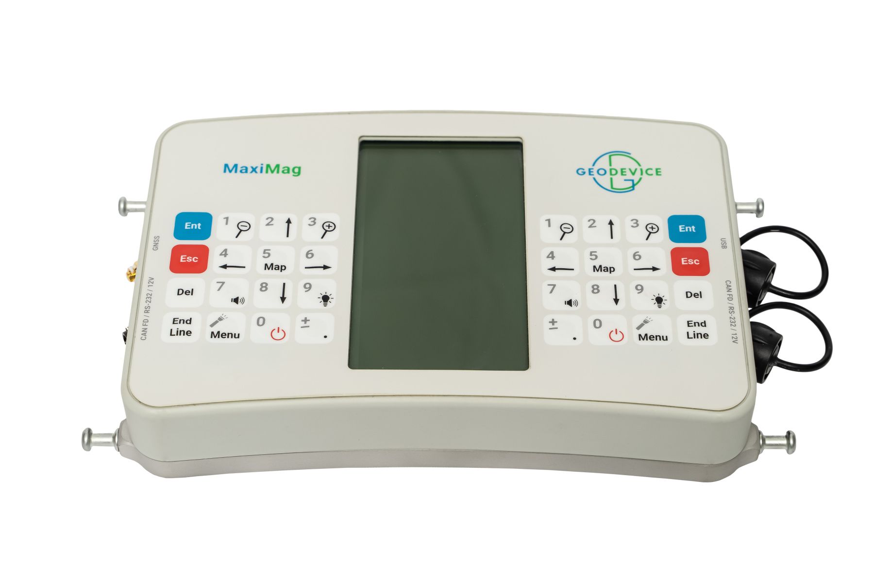
Easy-to-use tablet console
We have equipped the console with large daylight readable and heated display, a two-way keypad, modern wired interfaces and even a flashlight. The control of measured values and their quality is provided in digital, graphical, and audible modes. Line planning, operator guidance, saving of coordinates and exact times of measurements are provided by built-in multi-band GNSS receiver.
When external GNSS receiver is required, MaxiMag supports the standard NMEA-0183 protocol and can be connected to most navigation devices. Data download is available via USB, RS-232 or from the built-in industrial microSD card. We also made sure that all our parts and connectors were non-magnetic, which allowed to reduce the dimensions of the ready-to-go magnetometer set. Maneuvering with a magnetometer in forests and jungles has never been easier!
Magnetometer for magnetic observatories
High sensitivity, sampling rate, and accuracy (less than 0.1 nT) allow to use MaxiMag in magnetic observatories, but a more optimal solution to this problem is provided by the digital SmartMag / OVHmag sensors. Both magnetometers support real-time data broadcasting via CAN FD or RS-232 connection. Optional CAN-Ethernet interface unit can be connected directly to the standard network equipment. The digital CAN FD line can be up to several kilometers long. The device is supplied with the SmartManager software which has all the necessary functionality to work in the INTERMAGNET network of magnetic observatories.
Magnetometer parts and backpack harness
MaxiMag sensors are available in two modifications:
|
Modular |
Rigid |
|
|
Sensor vertical orientation |
+ |
- |
|
Sensor to electronics module connection |
Connector |
Permanent |
|
Carry-on case |
+ |
- |
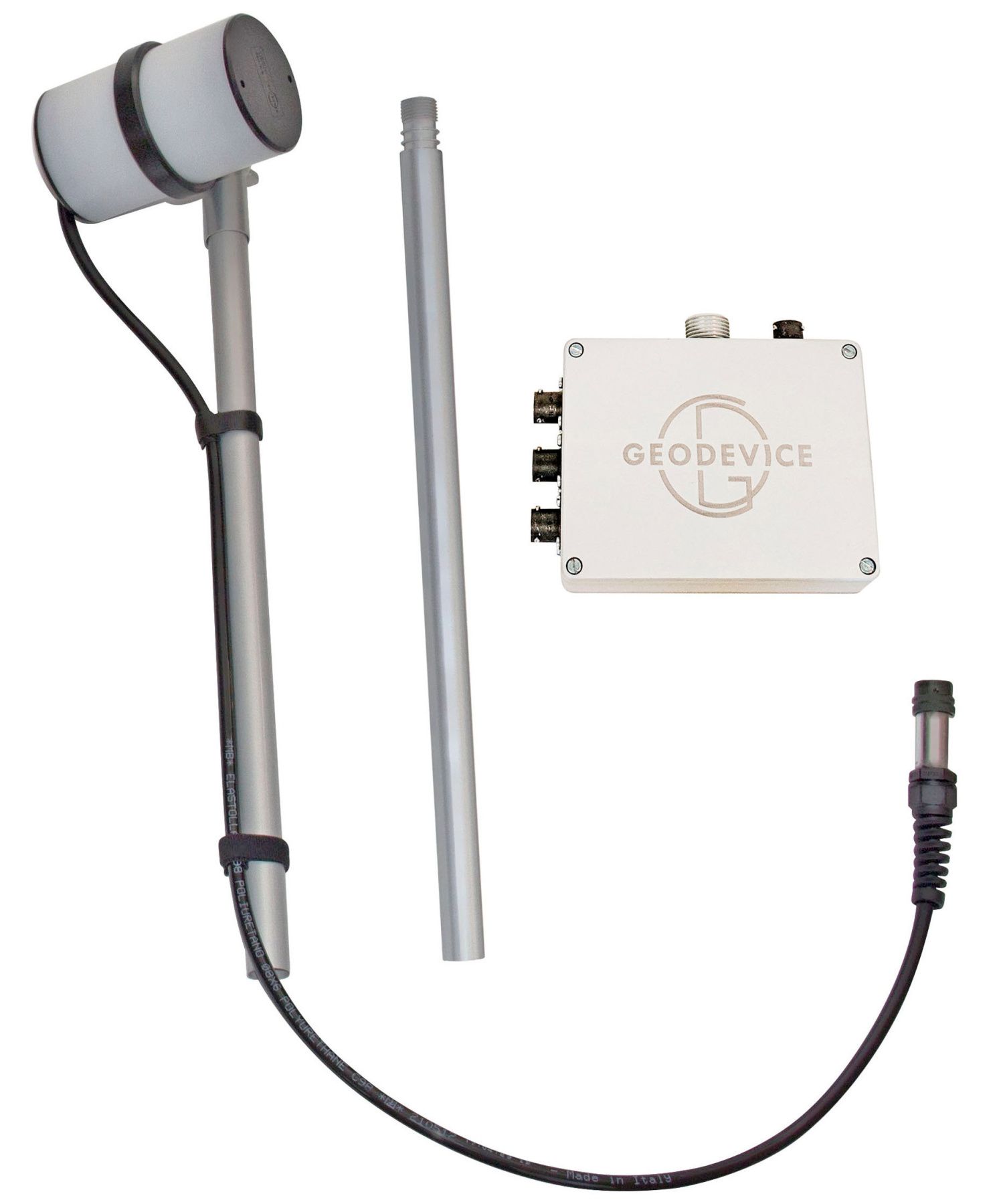
We recommend the rigid design for harsh environments at low temperatures where additional connectors and assembling the sensor with gloves on can be inconvenient. Modular sensors are convenient for use closer to equator and during transportation.
The magnetometer package contains a minimum number of parts to make assembly as easy as possible, but at the same time it consists of all the necessary components, so you do not have to buy additional cables, GNSS receiver and other “options and accessories” required for regular operations. Every magnetometer we ship is ready to be used in its basic configuration. Options add functionality but are not required by most users for standard operating scenarios.
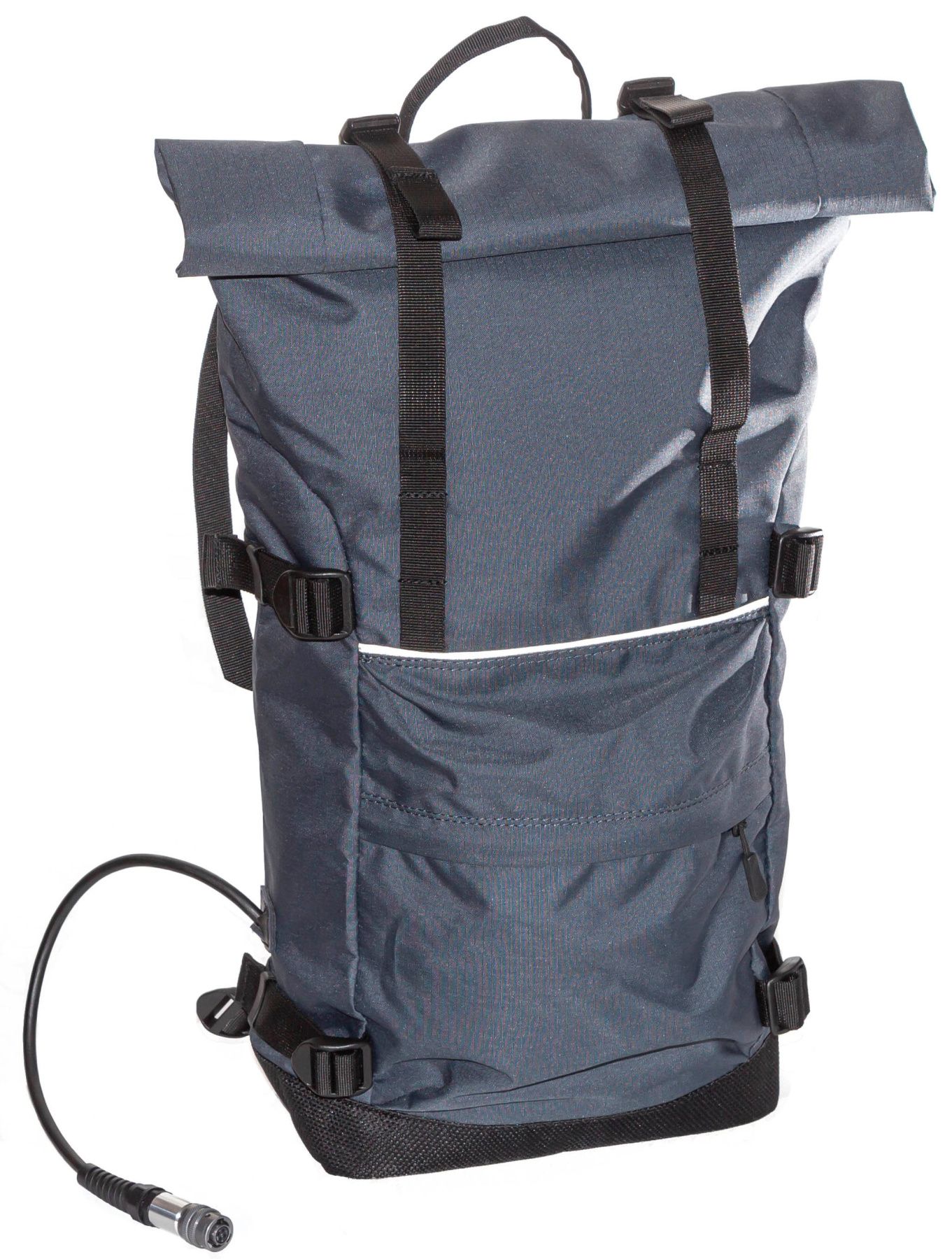
We have also designed an exceptionally comfortable and lightweight harness with plenty of customization to fit anybody. The duffel bag can be unzipped or used to carry an additional battery, clothing or lunch.
Power supply
MaxiMag operates over 11 hours of continuous measurements at -30°C from the battery included. At 20°C, the operating time increases to 17 hours. Continuous power supply in long term monitoring mode can be provided with a car battery, an optional low-noise power converter from 110/220VAC to 12VDC, or a solar panel.
Included Li-ion battery has the full temperature range from -40 up to +70°C and MSDS certificate for any kind of transportation.
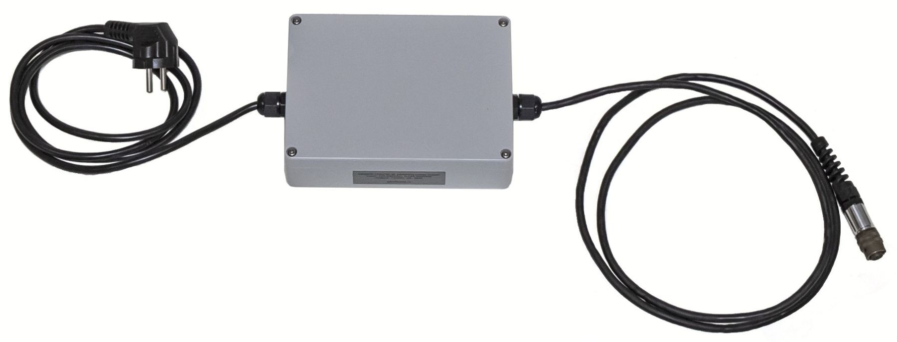
MaxiMag does not contain built-in batteries, that could complicate air transportation and sooner or later fail and require complex replacement.
Data format
User can create project folders that can be used to divide survey sites or data collection days. All measurements are saved in a TXT file in the project folder. The file from each magnetometer has a name containing the serial number of the console, the code of the measurement mode and the number of connected sensors. The files have a homogeneous structure, i.e. each measurement in the file is a line that contains all necessary information: UTC date and time, time zone, base name or line and station name, measured field, estimated error, sensor serial number, latitude and longitude in decimal degrees, altitude, UTM coordinates with automatic zone and hemisphere selection, horizontal and vertical accuracy. When working with a gradiometer, the line will contain measured field, estimated error, and sensor serial number for each of the connected sensors, and the file name will be different from the magnetometer mode, so the uniformity of the format will not be broken.
Even if there are many operators working on a survey site at the same time, you will always be able to identify which instrument was used for each single measurement in the database.
Metrology and noise protection - a guarantee of high accuracy
Every MaxiMag sensor is metrologically tested. We control the standard deviation of random error (noise), absolute accuracy and heading error.
The robust algorithms allow to perform measurements at high level of industrial noise, in a city environment, or right under high-voltage powerlines.
Reliability and warranty
Our R&D specialists have extensive experience in performing geophysical surveys. We are well aware that such equipment must be reliable, and the service must be fast and comfortable. We give 3 years warranty on all our magnetometers, and our technical support will promptly answer any of your questions. Our Overhauser sensors have the longest in the World lifecycle of more than 10 years. You can also take advantage of our trade-in program and replace your old instruments with the new MaxiMag.
Built-in multi-band GNSS receiver with centimeter level accuracy
Time and coordinates are provided by the built-in multi-band GNSS receiver with PPK feature, which allows to achieve a centimeter level accuracy. Stored RAW GNSS data could be easily converted to RINEX format. The console has GNSS receiver mode and can be used as a GNSS base, rover or tracker without mag sensor connected.
MaxiMag has built-in GNSS antenna and a connector for an external one. It also supports NMEA-0183 protocol and can be connected to external navigation devices via RS-232.
Important "little things"- Two-way keypad for both right- and left-handed people
- Ultra-bright LED flashlight for safe navigation in the dark
- Built-in multi-band GNSS receiver with PPK feature and base/rover modes
- Superior noise protection allows operation even under power lines
- More than 11 hours of continuous operation at -30°C and 17 hours at 20°C using the battery included
- Power cable for standard lead-acid battery included
Operating modes
- Mobile survey with walking or towed style and station measurements with line guidance
- Base station with continuous measurements
- Search mode for UXO objects detection or evaluation of a base station location
- GNSS receiver mode with ability to collect RAW GNSS data for a centimeter level accuracy with base or rover modes
- Mineral exploration
- Regional geological surveys
- Engineering surveys
- Pipeline mapping
- UXO detection
- Archaeological studies
- Oil and gas exploration
- Magnetic observatory
Basic delivery set:
- MaxiMag console with built-in multi-band GNSS receiver
- Digital Overhauser sensor OVHmag
- Li-ion battery 14.8V/4Ah with charger
- Sensor-to-console cable
- AGM battery power cable
- USB cable
- Backpack harness
- Transportation case
- MaxiMag console with built-in multi-band GNSS receiver
- Digital Overhauser sensor OVHmag - 2 pcs
- Li-ion battery 14.8V/4Ah with charger
- Sensor-to-console cable
- Gradiometer accessories:
- Gradiometer support
- Gradiometer bracket
- Gradiometer cable
- Power cable extension cord - AGM battery power cable
- USB cable
- Backpack harness
- Transportation case
- SmartMag base station
- Additional digital Overhauser sensors
- Gradiometer accessories
- Non-magnetic cart for multi-sensor gradiometer
- Non-magnetic tripod
- External GNSS antenna on rod
- Additional Li-ion battery
- CAN-Ethernet interface unit for connecting to PC/router
- RS-232 cable for real-time data broadcasting
- SmartManager software
- Power supply 100-240 VAC
|
Type |
Overhauser magnetometer |
|
Number of sensors |
up to 30 |
|
Dynamic range |
20 000 to 120 000 nT |
|
Absolute accuracy |
0.1 nT |
|
Sensor sensitivity |
0.021 nT/√Hz rms 0.012 nT/√Hz rms (on request) |
|
Resolution |
0.001 nT |
|
Gradient tolerance |
30 000 nT/m |
|
Sample rates |
0.2, 0.25, 0.5, 1, 2, 3 s and longer with 1 s step |
|
Sensors stability |
> 10 years |
|
Interfaces |
built-in: USB, RS-232, CAN FD. optional: Ethernet (CAN-Ethernet interface module) |
|
Maximum communication cable length |
up to 6 km (CAN FD), up to 100 m (RS-232) |
|
GNSS receiver |
built-in and optional external |
|
GNSS antenna |
built-in and optional external |
|
GNSS signals |
GPS L1C/A and L2C; GLONASS L1OF and L2OF; Galileo E1B/C and E5b; BeiDou B1I and B2I; QZSS L1C/A, L1S and L2C. SBAS: WAAS, EGNOS, MSAS, GAGAN. |
|
Connectors |
2 × CAN FD+12V / RS232+12V, USB, external GNSS antenna |
|
Display |
240 × 128, LCD |
|
Membrane switch panel |
32 buttons |
|
Internal memory capacity |
up to 32 Gb (industrial microSD) |
|
Power |
9.5-21 VDC, LiPo 3S/4S, Li-ion 3S/4S, LiFePo4 4S, or lead-acid battery |
|
Operating temperature |
–40 to +60 °C |
|
Li-ion battery |
14.6 V, 4 A·h |
|
Flashlight |
LED, 300 lumens |
|
Dimensions with connectors |
930×125×72 mm – rigid sensor 940×130×105 mm – assembled modular sensor 260×150×45 mm – console |
|
Item weight |
1.1 kg – console 1.4 kg – rigid sensor 1.5 kg – modular sensor 0.7 kg - Li-ion battery |
|
Weight of a set includes console, sensor, Li-ion battery, harness and sensor cable |
4 kg – magnetometer with rigid sensor 6 kg – gradiometer with rigid sensors |
|
Delivery package size and weight |
100 × 20 × 25 cm, 14 kg – magnetometer with rigid sensor 100 × 20 × 31 cm, 17 kg – gradiometer with rigid sensors 55.8 × 35.5 × 19 cm, 8.5 kg – magnetometer with modular sensor 62.5 × 50 × 29.7 cm, 17 kg – gradiometer with modular sensors |
Other